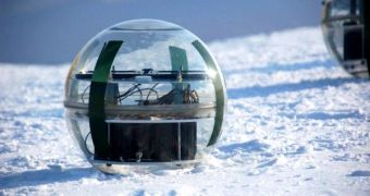
The CryoSat Validation Experiment 2008 will be carried out during a period of three weeks in the northern regions of Greenland and Canada by ESA scientists from Denmark, UK, Germany and Canada, during which time they will collect data regarding the properties of snow and ice covering both the land and sea regions of the Earth. The data will be later used in the Earth Explorer CryoSat mission to monitor the variations of ice thickness with time.
This year, ESA favored Canada and Greenland's ice caps, as opposed to the Arctic environment, because the northern Greenland regions are evaluated to be as cold as most of the regions of the Antarctic continent. Measurements will be taken simultaneously in three designated locations, the floating sea-ice north of the Canadian Forces Station Alert, the Devon ice cap in Canada and the Greenland ice cap.
Amongst the instruments carried to the study locations with the two Twin Otters there will be the ASIRAS radar altimeter and a laser scanner that will have the role of creating a map of the structures beneath the surface as well as an ice thickness measuring sensor on board a helicopter.
"One of the key experiments will be to acquire coincident airborne and helicopter measurements over sea ice. In two previous campaigns we have been only partially successful and we would really like to know whether this novel experiment activity is possible and can contribute to the validation of the CryoSat data over sea ice", said Rene Forberg, responsible with the Danish National Space Center airborne programme.
The CryoSat-2 mission, expected to start in 2009, will measure variations in land and sea ice thickness in order to reveal the effect of climate changes on the ice bodies across the Earth. Along with the Earth Observation satellite, CryoSat-2 should be able to accurately establish whether ice properties and thickness variations occur naturally or if any long-term trends can be determined. Similar missions have been conducted by ESA in the Arctic environment, including measurements with radar and laser altimeter instruments identical to those of the CryoSat-2.
"As the airborne measurements have much higher resolution than measurements made from a satellite, scientists can use the CryoVEx campaign to make direct comparison between ground and airborne measurements. The knowledge gained with local measurements is then extrapolated to a global scale to predict the influence of snow and ice properties on the CryoSat-2 measurements from space", says Malcolm Davidson, ESA's CryoSat-2 Validation Manager.
The CryoSat validation experiment is currently halfway through to completion and will serve the CryoSat mission as a reference during its ice-thickness variation measurements.

 14 DAY TRIAL //