 14 DAY TRIAL //
 Results from a new large-scale, high-resolution satellite data analysis indicate that forest degradation in the Brazilian Amazon has been underestimated by half.
The study, conducted by lead author, Dr. Greg Asner, of the Carnegie Institution's Department of Global Ecology and colleagues, is published in the October 21, 2005, issue of Science, and has far-reaching ecological impacts for the region and beyond.
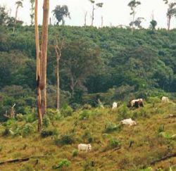
For a number of decades, people have been logging specific types of trees in the fragile rain forest by stealthily extracting them one-by-one, with the forest canopy covering their tracks.
"We discovered that annually an area about the size of Connecticut is disturbed this way," explained Asner. "Selective logging negatively impacts many plants and animals and increases erosion and fires. Additionally, up to 25% more carbon dioxide is released to the atmosphere each year, above that from deforestation, from the decomposition of what the loggers leave behind. Timber harvests are much more widespread than previously thought."
Brazil's Space Research Institute has used remote-sensing to accurately measure deforestation for over two decades. Surprisingly, though, little has been known about the extent of selective logging in the region because the satellite techniques could not penetrate the shielding upper layers of forest leaves.
From 1999 through 2002, the scientists used remote sensing, with a spatial resolution of 98 ft. x 98 ft. over millions of square miles, and selected on-ground surveys over the five states that account for 90% of all deforestation in the Brazilian Amazon. The annual extent of selective logging was found to be between 4,685 square miles (12, 135 km2) and 7,973 square miles (20,651 km2).
The researchers are hopeful that their new techniques can be expanded to monitor logging in other tropical forest countries.