14 DAY TRIAL //
 A new map put together by scientists at NASA and shared with the public earlier this week shows where the majority of the lightning bolts that strike our planet over the course of a year happen.
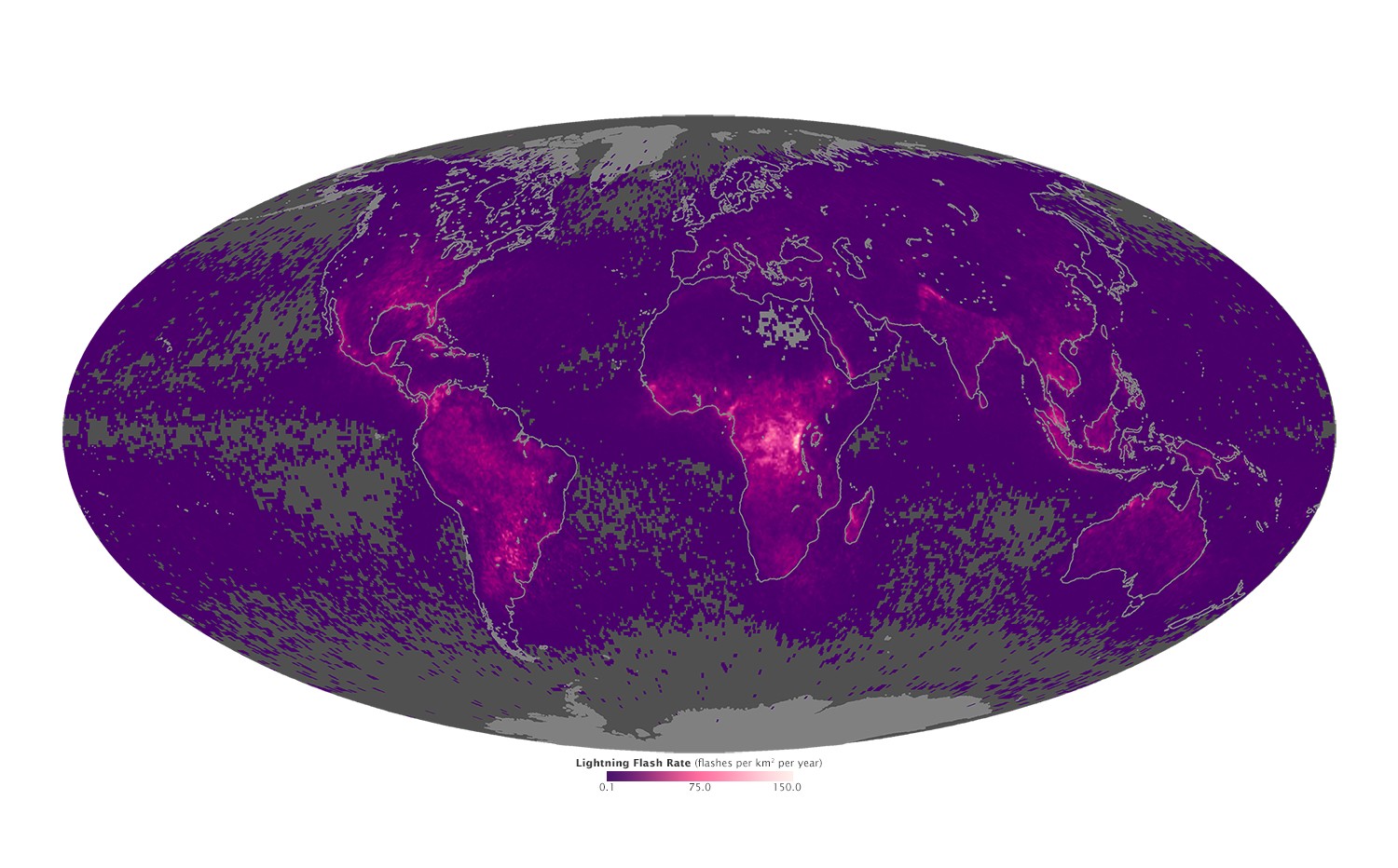
The map, available in the gallery below, was created using data provided by the Tropical Rainfall Measuring Mission satellite and the OrbView-1/Microlab satellite between the years 1998 and 2013 and 1995 and 2000, respectively.
It reveals that, rather than strike our planet evenly and in an orderly fashion, lightning events occur more often over land than over seas and oceans. Besides, they are especially common in regions close to the equator.
In this latest map released by NASA's Earth Observatory, the areas that witness the lowest number of lightning bolts over the course of a year are colored in gray and purple.
The rather unlucky regions that experience such events at an annual rate of up to 150 per square kilometer (0.4 square miles), on the other hand, are colored in pink.
By the looks of it, it's Central Africa and Northwestern South America that get the most lightning strikes on a yearly basis. Hence the fact that, on this map, they appear a bright pink.
As explained by the scientists who worked on creating this NASA map, it makes sense that lightning bolts are more common over land than they are over seas and oceans.
This is because the ground tends to heat and cool faster than water and is, therefore, more likely to birth atmospheric instability resulting in storms characterized by thunder and lightning events.