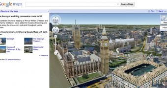
The British Isles are getting all excited about the whole royal wedding business and even Google can't stay away. Last moth it updated the 3D models in Google Earth for London, in preparation for the wedding and it's now showcasing how you can follow the procession with a view only the blue-blooded will get.
"As we approach Friday and the marriage of Prince William and Catherine Middleton, many locations in central London are in the spotlight," Phil Verney, Program Manager, Google Earth and Maps , wrote.
"As we get closer to the wedding day, we’ve also featured a few highlights along the procession route for you to explore in 3D using Google Maps with Earth View," he added.
"If you have the Google Earth plug-in installed, you can get started viewing these spots though an immersive tour right away, or you can download the Google Earth plug-in to explore Google Maps in 3D," he explained.
Obviously, if you have Google Earth installed, or the Earth plugin, you can 'fly' around London as you please and check out all the sites.
But if you want an accurate path of the actual procession, you can head on over to maps.google.com/royalwedding, a dedicated Maps page which houses a tour of the area of London where the procession will take place.
Alternatively, if you can't access Google Earth right now, you can check out the video here.
Ahead of the ceremony, Google added quite a lot of new 3D data to Earth for London. Not only are all of the buildings in the area modeled in detail, even the trees lining the streets and in the parks have been recreated.
Trees are a relatively new addition to Google Earth, they've only been around since version 6. Google added 12,000 of them in London alone, but there were already 80 million trees in Google Earth when the feature launched.

 14 DAY TRIAL //