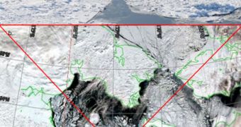
Despite it being December already, the ice extents experts were expecting to see forming in the Arctic have yet to materialize. A new report shows that, even at the end of November, the Hudson Bay was still pretty much free of ice, which is uncommon for this time of year.
Additionally, Arctic sea ice grew very slowly throughout last month, reaching only 9.89 million square kilometers (3.82 million square miles). The waters froze a lot slower than they usually do.
When comparing the current situation with data for the month of November collected between 1979 and 2010 – which is when satellite data of the Arctic began being available – we can see that this is the second-lowest November ice extent ever recorded.
The lowest extent was in November 26, when only 9.84 million square kilometers (3.80 million square miles) were measured to exist in the Arctic.
This year saw a 50,000 square kilometers (19,300 square miles) increase from 2006 levels, which is not really that big of a deal. Additionally, this year saw low sea ice extents forming in both the Atlantic and the Pacific Oceans.
Scientists with the US National Snow and Ice Data Center (NSIDC), who have been compiling such reports monthly for many years, say that, by the end of last month, nearly half of the entire Hudson Bay should have frozen over.
When investigating the bay on November 30, the group determined that only 17 percent of its surface had sea-based ice on it. This means that the ice extent was 12.4 percent below average for the Arctic as a whole.
“As temperatures drop in autumn, open water areas on the Arctic coastal seas quickly refreeze. After this rapid increase in ice extent during October, ice growth slows in November,” a NSIDC press release reads.
“This November, ice extent over the entire Arctic grew at an average rate of 74,000 square kilometers per day (28,600 miles per day), which is slower than average,” it adds.
“However, local weather conditions kept ice extent very low in some locations, contributing to the low extent for the month,” the document goes on to say.
One of the most important factors contributing to this was that the Siberian and Alaskan side of the Arctic were subjected to air temperatures that were 3 to 5 degrees Celsius (5 to 9 degrees Fahrenheit) warmer than normal for November.
“The loss of multiyear ice has contributed to low summer ice extents in recent years, because thinner first-year ice melts out more easily than older, thicker ice,” the NSIDC report adds.
“Last summer, multiyear ice that had moved into the Beaufort and Chukchi seas during the previous winter largely melted out,” they conclude.

 14 DAY TRIAL //