14 DAY TRIAL //
 It's one thing to stare at a 2D map of something, and another to reach out and feel every height difference between hills and mountains. A company called Micro CADD Services, or MCS for short, decided to make it possible to get a good look and “feel” of the country of Bahrain.
Most 3D printing technologies, like FDM (fused deposition modeling), create (small) objects from plastic, or light-cured resin in the case of SLA printers (stereolithography).
Mcro Technologies, however, has a certain 3D printing technique that builds objects from paper, of all things. Its 3D printer is called Matrix 300+ and can create things from both used and unused paper, and in color to boot.
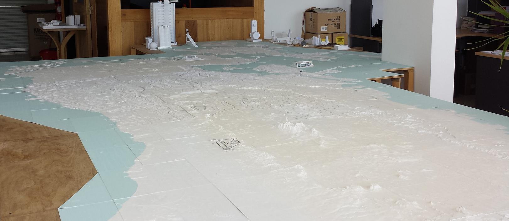
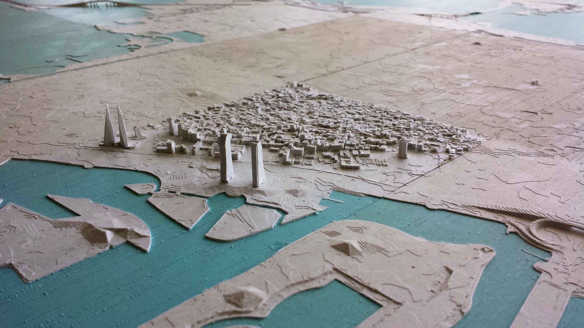
In this instance, Micro CADD Services (MCS) did not go for color. However, it did use the Matrix 300+ to create a large, 1:10,000-scale model of the country of Bahrain.
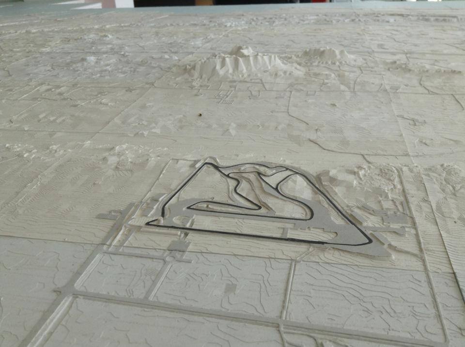
The entire model measures 2.2 x 5.4 meters / 7.12 x 17.71 feet and will take the place of traditional maps when it comes to planning events / tactics or other activities involving large groups of officials. Most of the map is left blank white, but there are some spots where it is colored green.
As you might expect, creating the 3D printed map was not easy. After all, 3D printers cannot make large objects like this one. So the model had to be created piece by piece.
To pull it off, MCS used SliceIt, a piece of software also provided by Mcor Technologies which separated the digital model of Bahrain into small tiles.
After that, they printed each tile and glued them together. Roads came after, strips of grey paper that were also 3D printed via the Matrix 300+. Thus, roads were slightly raised, as they are in reality compared to the fields they run through.
Everything was built out of A4 business paper, the sort made for inkjet printers. Obviously, employing used paper would have led to an ugly, smudged, irregularly colored model that would have been more of an eyesore than a wonder.
Of course, if MCS had one for the fully colored option, that would not have been a problem. They did not, however, and we are not sure as to the reason. Perhaps it would have reduced its possible uses. Leaving it a neutral white will make it easy to switch from using it as a natural map to viewing it as a political map, for example. At least the sea was colored a light shade of blue.