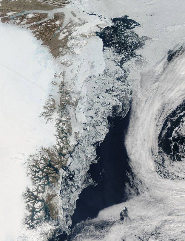
A new satellite image released by NASA scientists this Monday shows bits and pieces of ice floating about in the Greenland Sea near the Arctic.
The true-color view, available below, was obtained by the space agency's Aqua satellite earlier this year, on July 16.
At that time, northern territories and the Arctic were experiencing hot summer temperatures, which explains the small army of chunks of ice off Greenland.
“As the northern hemisphere experiences the heat of summer, ice moves and melts in the Arctic waters and the far northern lands surrounding it.”
“Frigid air from interior Greenland pushes the ice away from the shoreline, and the mixing of cold water and air allows some sea ice to be sustained even at the height of summer,” NASA explains.
This past July, the Arctic's sea ice coverage was measured to be about 350,000 square miles (almost 910,000 square kilometers) below the average for the period 1981 to 2010.
Then again, global temperatures did set a new record for heat, i.e. 1.46 degrees Fahrenheit (0.81 degrees Celsius) over the 20th century, so it makes sense that the Arctic did not remain impervious to this shift in Earth's climate.
Researchers warn that, should global temperatures continue to increase in the years to come, which will surely happen unless we put a dent in greenhouse gas emissions, the Arctic stands to lose even more ice and eventually turn into one big puddle.

 14 DAY TRIAL //

