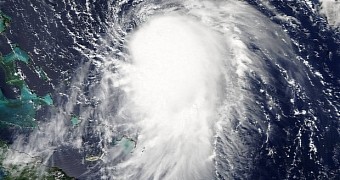
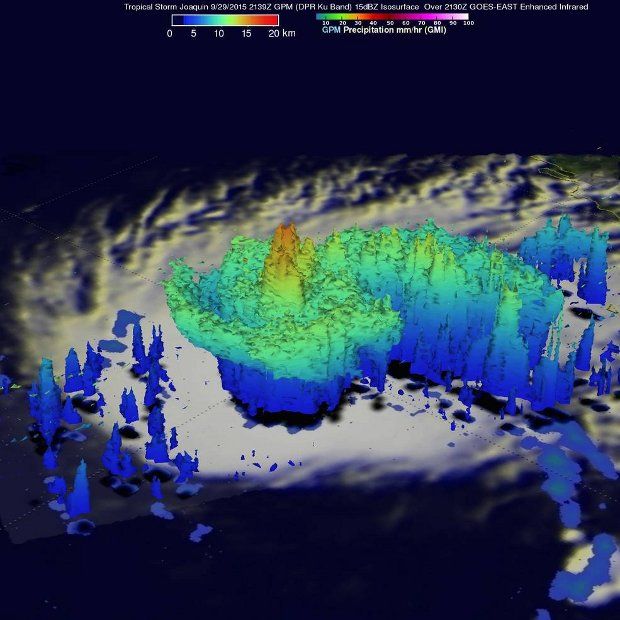
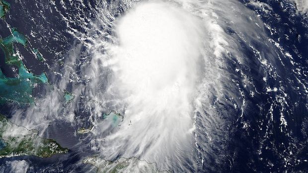
This past September 29, NASA's GPM Core and Aqua satellites flew over hurricane Joaquin, then just a tropical storm, and studied it as it was midway between the Bahamas and Bermuda.
The satellites recorded rainfall, as well as cloud height and extent. The view they produced, available below, showed scientists that the storm was at the time more organized than it had been just the day before.
Sure enough, on September 30, Joaquin was no longer merely a tropical storm. It had intensified and grown to become a powerful hurricane, the third of this year's Atlantic season.
NASA scientists say that, at the time when it was imaged by the GPM Core and Aqua satellites, Joaquin was about 400 miles (roughly 650 kilometers) east of the northwestern Bahamas.
It was moving slowly west-southwest and the reason it had not yet strengthened was because of wind shear. Once this influence was lost, the storm progressed to become a hurricane.
“At the time Joaquin had been battling northerly wind shear, which was impeding the storm's ability to strengthen,” they write in a report documenting the storm's progress.
“However, compared to earlier in the day, the system was beginning to gain the upper hand as the shear began to relax its grip,” the NASA team further detail the birth of Hurricane Joaquin.
The hurricane is expected to grow even stronger
Satellite data indicates that Hurricane Joaquin will only grow stronger over the next couple of days. NASA scientists documented heavy rain just right of its center, a sign that heat is being released. In turn, this is expected to fuel the storm's circulation and have it grow even more intense.
Then, so-called convective towers, i.e. massive vertical clouds, reaching altitudes of up to 10.1 miles (16.3 kilometers) are another sign that the hurricane is bound to get stronger than it already is.
When studied by NASA satellites, Joaquin packed winds reaching speeds of 65 miles per hour (105 kilometers per hour). As the hurricane intensifies, the winds that come with it will too pick up speed. Latest information says wind speeds stand at about 80 miles per hour (130 kilometers per hour).
Researchers expect that, on the night of September 30 and then on October 1, the hurricane's center will travel either close to or over parts of the central Bahamas. Hence, a warning was issued for this region.
“On September 30, the National Hurricane Center issued a Hurricane Warning for the central Bahamas including Cat Island, the Exumas, Long Island, Rum Cay, and San Salvador,” NASA says.
“A Hurricane Watch is in effect for the northwestern Bahamas including the Abacos, Berry Islands, Bimini, Eleuthera, Grand Bahama Island, and New Providence, but excluding Andros Islandk,” it adds.
It is expected that Hurricane Joaquin will also take its toll on the southeastern coast of the US. Thus, specialists warn that, by Thursday, the region is vulnerable to floods, life-threatening surf and rip current conditions.

 14 DAY TRIAL //


