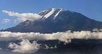
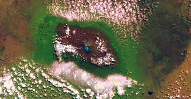
This Wednesday, researchers with the European Space Agency (ESA, for short) released a glorious view of Mount Kilimanjaro as it appeared to the Proba-V satellite when it flew over it and imaged it earlier this year, on June 14.
The image, available below, shows Mount Kilimanjaro surrounded by dense clouds hovering over its southern and northern slopes. Then, the blue splotch atop it is the snow and the ice forever covering its peak, ESA scientists explain.
“This 100-meter [328 feet] resolution false color image from Proba-V's main Vegetation camera on 14 June 2015 shows Kilimanjaro enveloped by clouds to the south and north.”
“The gradual decrease of vegetation with altitude can be seen by the colors changing from green to brown and finally light blue, representing the summit's glacier,” they say.
These days, Mount Kilimanjaro is Africa's absolute highest mountain. Thus, scientists say that, at its tallest, it reaches an altitude of 5,895 meters (roughly 19,340 feet).
Mount Kilimanjaro, located in Tanzania in eastern Africa, is actually a dormant volcano with three volcanic cones named Kibo, Mawenzi and Shira. It's been around for ages, with its Shira center first erupting some 2.5 million years back.
The first people known to have reached Mount Kilimanjaro's summit were explorers Hans Meyer and Ludwig Purtscheller, who scaled the mountain in 1889. Since then, hundreds of people have attempted the climb.

 14 DAY TRIAL //

