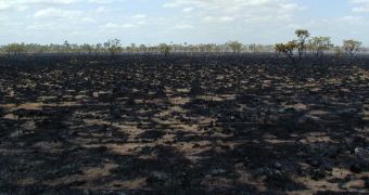
A group of investigators from the University of California in Irvine (UCI) announces the development of a prediction tool that is capable of indicating wildfire severity and distribution patterns throughout South America months in advance. The tool can also be applied to the Amazon rainforest.
Using NASA funding, the researchers analyzed more than 10 years' worth of data related to fires affecting the continent, and were able to derive a series of patterns from these information. They say that the natural disasters occur in a predictable manner.
The tool may therefore be of great use to authorities and emergency responders, especially in terms of getting ready ahead of time. When the fires do occur, they will be put out a lot faster, since a coordinated response will have already been set in place.
Past investigations have already revealed that human settlements are the main driving force behind wildfires. However, the new study indicates that factors which were previously not accounted for may also play an important role.
The group says that small variations in oceanic temperatures have a tendency to amplify the impact that humans have on natural habitats. These shifts may also be held accountable for the variability experts noticed in the number of trees catching on fire every season.
“Higher than normal sea surface temperatures in the Atlantic and the Pacific proved to be red flags that a severe fire season was on its way in four to six months,” UCI science team leader Yang Chen says.
The temperature fluctuations researchers speak of can be as small as 0.25°C (0.45°F) in the North Atlantic and 1°C (1.8 °F) in the Central Pacific. When detected, authorities can expect to have a busy wildfire season on their hands.
In addition, the UCI group also found that changing weather patterns are forcing precipitations to shift from their usual routine in the southern Amazon. The main implication here is that soils don't get nearly enough water to become saturated.
“Months later, humidity and rainfall levels decline, and the vegetation becomes drier and more flammable,” UCI scientists and study coauthor James Randerson.
He explains that the data used to assess these connections were collected using the Moderate Resolution Imaging Spectroradiometer (MODIS) instruments on the NASA Terra and Aqua satellites.
“For the 2010 season, the model successfully captured not only the severity of wildfire activity, but it also got much of the east-west spatial distribution right,” Randerson says. The team expects to see the model being widely-used within a very short time.

 14 DAY TRIAL //