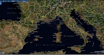
Microsoft is kicking Virtual Earth up a notch. The Redmond giant's mapping, location and search service has evolved to the next stage, bringing new components including the Virtual Earth Web Service and the Virtual Earth Map Control 6.2. Chris Pendleton, Virtual Earth Tech Evangelist, Microsoft Live Search, indicated that the refresh of Virtual Earth is designed to deliver a new level of opportunities as far as international content is concerned, but not only.
“The latest release of the Virtual Earth platform offers a richer user experience and more intuitive functionality. There are more ways for customers to search for more types of mapping information, in ways that are tailored to their individual needs. New Virtual Earth Web Services. The new SOAP based Virtual Earth Web Services v. 1.0 offers static map images (.gif, .jpeg and .png), direct map tile access, one-box search functionality, geocoding, reverse geocoding, routing . It supports Virtual Earth on the desktop and on mobile devices,” Pendleton revealed.
The growth of Virtual Earth is synonymous with expanded support for mobile platforms. According to Pendleton, Virtual Earth-based applications can now be developed not just for Windows Mobile but also for RIM Blackberry and Apple iPhone. In addition, Virtual Earth users in Western Europe will be able to enjoy access to localized maps in English, German, French, Italian, and Spanish. At the same time, users worldwide will be able to leverage the new international reverse geocoding to locate addresses across the world.
“The Virtual Earth platform is designed for the enterprise and public sector user, from features to support. This 6.2 release enhances the platform infrastructure with new geocoding and parsing improvements, as well as more detail revealed in relevant ways,” Pendleton added enumerating a series of new or enhanced features, including: pushpin clustering; boosted number of rooftop geocodes; near-matching capabilities; landmark hints in routing; fresh imagery metadata; and even weather integration.
Virtual Earth Web Services SDK, Version 1.0 is available for download here.
Virtual Earth Map Control SDK 6.2 is available for download here.

 14 DAY TRIAL //