Soil moisture is something you usually have to be close to check, but NASA believes enough time has passed without a sure way to measure is from afar. And by afar, we mean from way up in orbit.
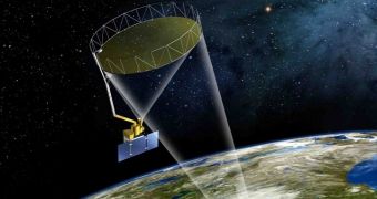
That is why NASA has decided to start developing the Soil Moisture Active Passive (SMAP) satellite, which will launch three months from now, in November.
The SMAP satellite will hover around the Earth at a height of 227 miles, or 365 kilometers, in a sun-synchronous orbit circling the word from one pole to the other, or very nearly.
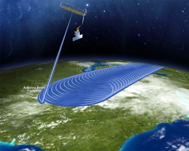
It will have an L-band radar and an L-band radiometer that will be able to scan the top 5 cm / 2 inches of the planet soil, hence its ability to measure ground moisture. Previously, it was impossible for scans to reach so deep.
The goal is to always be aware of what areas around the world are suffering from drought, and to anticipate moisture trends.
Previously, this could only be done through spot measurements, which, unfortunately, are unreliable at best, especially when you're trying to get readings over large areas.
The SMAP Satellite should be able not only to take stock of such areas, but to actually map the entire planet once every two or three days.
Farmers won't get field-to-field statistics, but the satellite will have a resolution of around 31 miles, or 50 kilometers, so it will allow for the best moisture maps to date to be created.
This, in turn, will allow farmers of rain-fed crops to schedule their planting more efficiently, making the best of their crops each year. It won't yield immediate results of course, but it should start to be felt in a few years.
At that point, both crop death prevention and recovery from drought should raise in efficacy. However, this is not the only potential use that NASA sees for the SMAP satellite.
In addition to better food yields, the SMAL Satellite is seen as a way for NASA to understand better how the planet's energy, carbon and water cycles are connected. This would, in turn, lead to more accurate climate models and weather forecasts.
Who knows, perhaps the readings will eventually allow us to build our own weather machines, and use them in a way that won't screw up the natural weather system and ecosystems dependent on it. That's probably decades away though, if not centuries.

 14 DAY TRIAL //

