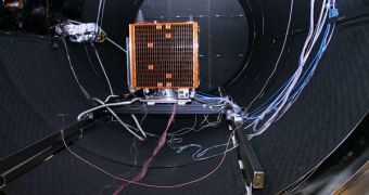
The United Kingdom will make today another addition to its Disaster Monitoring Constellation, when it will launch the UK-DMC2 and Deimos-1 satellites into orbit. The goal of the spacecraft is to offer government agencies images from various areas very fast, and their primary use will be for assessing the seriousness of conditions that may occur when a natural disaster strikes. Floods, earthquakes, and wildfires will all have their pictures taken immediately after they happen, and the relevant information will be beamed back to authorities, so that response teams can devise the best possible rescue strategy under the circumstances, the BBC News reports.
“After a major disaster, the first thing you need to do is supply the relief workers with an up-to-date map. If there's been a big flood, there will be landslides, roads will have been washed away and bridges will be down. So you need a new map that shows you how to get around the area; and it's the satellite imagery that helps you do that,” Surrey Satellite Technology Limited (SSTL) expert Philip Davies explains the purpose of the new instruments. The UK company was in charge of the manufacturing process for the new satellites.
They are scheduled for lift-off later today, at 1846 GMT, aboard a converted Soviet-era SS-18 intercontinental ballistic missile (ICBM). The launch site is at the Baikonur cosmodrome, in the Kazakh steppe, a facility operated by the Russian space agency RosCosmos. This is the world's busiest spaceport, and has literally witnessed hundreds of rocket launches to one destination or another over the years. The ground on which it is built is leased to Russia under a 50-year agreement.
Speaking about previous satellite generations, Davies says that, “The biggest use of the DMC was after the Asian tsunami is [sic.] 2004. We used the fact that it's a constellation and can cover very wide swaths to image the entire Indian Ocean coastline. Other satellites may have been able to deploy high resolutions at particular locations, but we were the only system that could cover the entire coastline at a reasonable resolution.” SSTL is also the company that built the Galileo spacecraft, the first of Europe's own satellite navigation systems.

 14 DAY TRIAL //