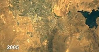
Working together with experts at the US Geological Survey (USGS), software experts at Google created a new tool for observing the changing Earth, which enables users to view time-lapse videos of how certain areas of the world evolve over the years.
The online tool contains more than 13 years’ worth of satellite data, primarily compiled by the Landsat satellites the USGS operates. These spacecraft are uniquely qualified to survey aspects such as deforestation, urban sprawl, land use, agricultural and crop patterns, and so on.
Within the Google Earth Engine, experts included the capability to create time-lapse video clips of how an area selected by the user has evolved over the last 40 years (since the first Landsat was launched).
The creation of such advanced land survey tools was made possible by the fact that the Landsat constellation has been monitoring the Earth continuously for more than four decades, Our Amazing Planet reports.

 14 DAY TRIAL //