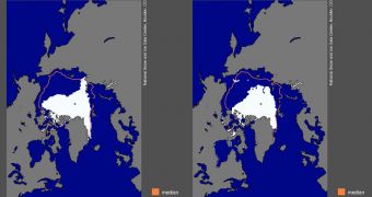
According to investigators at the US National Snow and Ice Data Center (NSIDC), it would appear that Arctic sea ice extent for this year has exceeded the record minimum established in 2007. This announcement refers to the lowest values recorded since satellite measurements of the Arctic began, in 1979.
The NSIDC says that these are not the final results for the month of August, and do not cover the entire melt season. While they are based on projections and past events, the ice loss data may in fact be very conservative, scientists at the NOAA organization say.
They explain that the 2012 Arctic melt season will be completed at the end of September. This means that a full analysis of the way the ice evolved this year will become available in early October.
What is clear up to this point is that daily sea ice extent values continue to track below their 2007 counterparts, with only two or three more weeks left in the melting season. This is why the NSIDC group is convinced that this year's values will be below those recorded 5 years ago.
“Please note that this is not an announcement of the sea ice minimum extent for 2012. NSIDC will release numbers for the 2012 daily minimum extent when it occurs. A full analysis of the melt season will be published in early October, once monthly data are available for September,” experts say.
On August 26, 2012, Arctic sea ice extent only reached a total of 4.10 million square kilometers (1.58 million square miles), data show. This value is 70,000 square kilometers (27,000 square miles) lower than recorded on September 18, 2007, when the all-time record minimum was recorded.
At that time, the NSIDC determined that the entire ice shelf at the North Pole covered only 4.17 million square kilometers (1.61 million square miles). It's also very interesting to note here that the six lowest ice extents in the satellite record were measured between 2007 and 2012.
“After tracking near 2007 levels through July, the extent declined rapidly in early August. Since then, the loss rate has slowed some, averaging about 75,000 square kilometers (29,000 square miles) per day – equivalent to the size of the state of South Carolina,” the team says.
“However, this is still much faster than the normal rate at this time of year of about 40,000 square kilometers per day (15,000 square miles),” NSIDC researchers go on to say.
Additional data on the 2012 melting season will become available in early September (for the month of August) and early October (for September). Scientists will then incorporate these values into long-term trends, and use the data to determine how global warming is affecting the North Pole.

 14 DAY TRIAL //