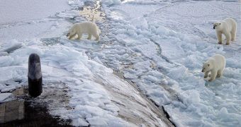
It's no longer a secret to anyone that the extent of the multi-year ice sheets in the Arctic is rapidly declining. At this point, there are several predictions as to when the North Pole will become completely clear of ice during the summer months, but none of them is too encouraging. Unlike Antarctica, which is based on ground, the Arctic is made up entirely of floating ice, and one of the main reasons why it's melting – other than global climate change – is the fact that the ocean underneath is warming. But researchers say the true extent of ice loss is still unknown, AlphaGalileo reports.
Over the past couple of years, the estimates of when the ice covering the North Pole will disappear have been reducing constantly. Dr. David Barbers explained why in new conference, which took place yesterday, June 11. The expert was the leader of one of the most important research initiatives carried out under the International Polar Year (IPY) flag – The Circumpolar Flaw Lead (CFL) system study. The team that conducted the investigation featured more than 370 members from 27 countries. The status of multi-year ice was the main goal of the study.
“Scientists spend a lot of energy discussing the squiggly line generated for satellite data on sea ice extent. But the extent does not reflect the real condition of the sea ice. I think we are all looking forward to getting reliable data on the thickness from Cryosat. Because what really counts is the condition and thickness of the multi-year ice. Even though the extent of the ice went up, both winter maximum and summer minimum, in 2008 and 2009, the amount of multi-year ice continued to decline rapidly,” he explained. The expert added that the North Pole lost over 2.5 million square kilometers of ice over the past three decades, which is the equivalent of 70,000 square kilometers per year.
“Last summer we studied sea ice recovery in the Southern Beaufort Sea aboard the research vessel Amundsen. We expected to be stopped by thick multi-year ice, but the Amundsen, ice classed to make it through 1,2 meters of ice, was not stopped. We realized that the ice was rotten. We also observed that thaw pools were formed on top of the ice, gradually melting through the multi-year ice. This process left the multi-year ice as floating lumps. When the freeze started, what looked like solid ice, was really the lumps with a 5 [centimeters] thin ice layer on top. This ice was mistaken by the radar for multi-year ice,” the scientist revealed at the meeting.

 14 DAY TRIAL //