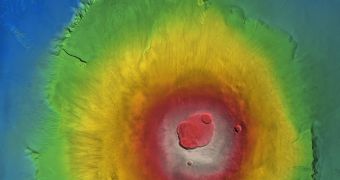
Most of the images taken by ESA's Mars Express, although extremely spectacular, usually miss critical features such as the topography of the photographed surface area, or vertical elevation of the structures and the surrounding regions. On the other hand, the High Resolution Stereo Camera on-board the Mars Express orbiter can process images through, to create a high-resolution Digital Terrain Model, which is basically a three-dimensional image of the Martian surface.
The ESA has released such an image yesterday, showing the topography of Olympus Mons, the highest volcano on the surface of Mars, towering about 26 kilometers over the surrounding areas. Digital Terrain Models of Mars help astronomers to get a better understanding of the planetary surface, by providing them with instant information regarding the heights of cliffs, the slope of hillsides, altitude and slop of lava flows. Such data is essential for trying to analyze water or lava flows on the surface of a planet.
Also, 3D models of a certain region of Mars' surface may help data interpretation in missions such as Mars Advance Radar for Surface and Ionosphere Sounding. Knowing exactly the configuration of the structures on the surface eases the processing of data obtained through radio scanning techniques.
So far, the topographic data provided by the Mars Express DTM has been the most detailed ever conducted on the surface of Mars. The HRSC camera on-board the Mars Express creates high resolution photographs, by taking individual images of the surface while moving in its orbit. By putting multiple images together, the HRSC may cover larger areas than previously possible. Some of the highest resolution images obtained have resolutions as high as 10 meters, and provide data regarding elevation with resolutions up to 50 meters, and margin of error of 10 meters.
The resolution of the images is not directly related to the resolution of the camera, but may vary in concordance with the hight of the orbit of the Mars Express spacecraft. Thus, while in a lower orbit, the HRSC can take images of the surface with greater resolution. The Mars Express orbiter is scheduled to remain operational at least until 2009 and, during this time, the HRSC will continue to map the surface of Mars.

 14 DAY TRIAL //