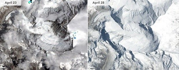
Earlier this year, the country of Nepal in Asia was hit by a major earthquake with a recorded magnitude of 7.8. The tremor brought down hundreds of buildings and killed over 8,000 people.
According to a new report produced by researchers with the National Administration of Surveying, Mapping and Geoinformation in China, the shake also pushed Mount Everest out of place.
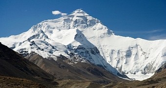
Specifically, the report says that, during the powerful 7.8-magnitude earthquake that shook Nepal on April 25, Mount Everest was forced 1.18 inches (approximately 3 centimeters) southwest.
The shift was a step back for the mountain
Mount Everest is Earth's highest mountain. It is part of the Himalayas, a mountain range in South Asia birthed by interactions - collisions, to be more precise - between the tectonic plate carrying India and that supporting Eurasia.
Since the major tremor that hit Nepal on April 25 occurred precisely along the line of convergence of these two plates, it makes sense for Mount Everest to have been affected by the shake.
The report produced by scientists with China's National Administration of Surveying, Mapping and Geoinformation says that, prior to the 7.8-magnitude earthquake, Mount Everest was known to be moving northeastward at a rate of 1.5 inches (4 centimeters) per year.
Due to a relaxation in the planet's crust following the tremor, however, the mountain changed direction and, as mentioned, moved 1.18 inches (3 centimeters) southwest, the researchers detail.
“The mountain has been constantly moving to the northeast, and the earthquake made it bounce a little bit in the opposite direction,” explains Xu Xiwei of the Institute of Geology at the China Earthquake Administration in Beijng.
“The scale of such movement is normal and won't affect life in the area,” the specialist goes on to comment on this infinitesimal change in local landscapes in Asia, as cited by China Daily.
The team of Chinese researchers claims to have found no evidence that the tremor also left Mount Everest just a tad shorter than it used to be. Another study made public towards the end of April, however, referenced a 1 inch (2.5 centimeters) drop in the mountain's altitude.
The tremor moved the ground around Kathmandu
Mount Everest might have been forced southwest and possibly even shrunk during the April 25 quake, but these shifts in its position and altitude pale in comparison to how the tremor transformed the region around Kathmandu, Nepal's capital city.
Thus, scientists with the European Space Agency say that, according to data obtained by the Sentinel-1A satellite, the earthquake caused as much damage as it did because it lifted the ground around Kathmandu by about 3 feet (nearly 1 meter).
This earthquake-induced land deformation is said to have affected an area measuring approximately 120 kilometers (75 miles) in length and 50 kilometers (30 miles) in width.

 14 DAY TRIAL //

