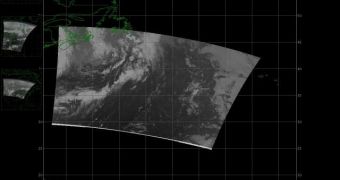
The High Rate Data (HRD) antenna aboard the Suomi National Polar-Orbiting Partnership (NPP) satellite has recently been turned on, and is now relaying significant amounts of meteorological data back to mission controllers on Earth.
Suomi NPP is a next-generation spacecraft built by Ball Aerospace & Technologies Corporation, which was launched into a Sun-synchronous orbit some 824 kilometers (512 miles) above Earth's surface aboard an ULA Delta II delivery system, on October 28, 2011.
Scheduled to remain operational for at least 5 years, the advanced Earth-monitoring satellite is now being operated by the US National Oceanic and Atmospheric Administration (NOAA), in cooperation with the American space agency.
Its main role is to provide viable, reliable, real-time data on current weather events. In the short term, these data are used to inform weather forecasts around the world. In the long run, they are included in climate models that predict how global warming will change our planet.
Most of the data Suomi NPP is now relaying to Mission Control flows through the HRD antenna. The cone-shaped appendage is capable of direct broadcast, providing data to multiple users simultaneously.
In this manner, scientists can keep track of advancing forest fires, flash floods, dwindling fish stocks and the routes of polar icebergs that make their way to areas of the world's oceans that are bustling with ship traffic. s
“Direct Broadcast data is unique in that it provides real-time data on a regional basis which enables quick evaluation of events at a local level,” explains Patrick Coronado, an expert at the NASA Goddard Space Flight Center (GSFC), in Greenbelt, Maryland.
He also holds an appointment as the head of the Direct Readout Laboratory at the Center. According to the scientists, Suomi NPP passes over its dedicated ground station, in Svalbard, Norway, about 14 times daily. The satellite dumps the data it collects between each pass every time it flies above the station.
The data products for environmental monitoring and research are compiled through the use of advanced mathematical algorithms inside a computer system called the Interface Data Processing Segment (IDPS).
“We apply direct broadcast data daily to produce an entire suite of fire mapping and geo-spatial products. We can produce about a dozen science products within 20 minutes after we receive the raw data from the satellite, including detection of active fires,” says scientist Brad Quayle.
“Utilizing other means to acquire imagery and derive products could add several hours to the process. Providing accurate and reliable information with minimal latency aids decision makers in various aspects of fire management,” he adds.
Quayle holds an appointment as an image analyst at the Department of Agriculture's (USDA) Forest Service Remote Sensing Applications Center.
The USDA compiles a number of assessments based on data from the Moderate Resolution Imaging Spectrometer (MODIS)-class instruments on the NASA Aqua and Terra satellites. They will now add data from the Suomi NPP Visible Infrared Imaging Radiometer Suite (VIIRS) to their products.

 14 DAY TRIAL //