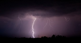
In a recent report in the journal Nature Communications, researchers with the Florida Institute of Technology describe seven positively stunning upward-moving lightning discharges that they were lucky enough to document over the Atlantic.
The bizarre lightning events, shown in the video below, occurred during the Tropical Depression Dorian that formed in the Atlantic quite a while back, in 2013. More precisely, they were filmed in that year's August, the Florida Institute of Technology scientists say.
When lightning strikes upwards
In their paper in the journal Nature Communications, the researchers who studied and filmed these odd events say that, although rare, upward-moving lightning discharges are not exactly the freaks of nature many probably think them to be.
On the contrary, scientists have so far had the chance to document enough such events to classify them into starters, jets and gigantic jets, and even get an idea of how they can affect the atmosphere's makeup and even disturb human activities.
Thus, upward-moving lightning discharges classified as starters reach altitudes of about 20 to 30 kilometers (12.5 to 18.5 miles). Jets and gigantic jets, on the other hand, reach altitudes of 40 to 50 kilometers (25 to 31 miles) and 70 to 90 kilometers (43.5 to 56 miles), respectively.
As far as their potential effects are concerned, scientists say that such events can not only influence cloud formation but also upset the atmosphere's electrical circuit and chemistry. In doing so, they can disturb radio signals and impair long-range communication.
The 2013 discharges came in all shapes and sizes
What's interesting is that the seven upward-moving lightning discharges that were caught on camera over the Atlantic in August 2013 came in all shapes and sizes. More precisely, researchers say that, while some were just starters, others were jets and even gigantic jets.
This is all the more intriguing given the fact that, up until that year's Tropical Depression Dorian, researchers only managed to stop one type of upward-moving lightning event at a time. How and why this storm produced all three types remains a mystery.
Florida Institute of Technology researcher Ningyu Liu and colleagues say that, according to data at hand, all the seven upward-moving lightning discharges that they caught on camera in August 2013 originated from the same thundercloud region.
“We are very curious about why this particular storm was able to generate those different forms of the upward electrical discharges, and what storm properties enabled the upward propagating leaders originating deep inside the storm to escape into space,” specialist Ningyu Liu said in a statement.
The scientists now wish to put together several computer models and use them to try and gain a better understanding of how thundercloud regions can sometimes birth upward lightning events. These computer models will be based on data obtained while studying the odd discharges they filmed in 2013.

 14 DAY TRIAL //