14 DAY TRIAL //
 Mobile phone users fond of Google Maps and on the various features the solution offers to them on their handsets should be happy to learn that some new enhancements are available for them. Street View in Google Maps for mobile now offers imagery from 7 continents, with the addition of new locations into the mix.
Street View was added to Google Maps for mobile about two years ago, in an attempt to offer handset users the possibility to explore the world at street level straight from their devices while on the go.
According to the latest announcement from Google, with the latest additions to Street View, all 7 continents are covered with imagery at street level.
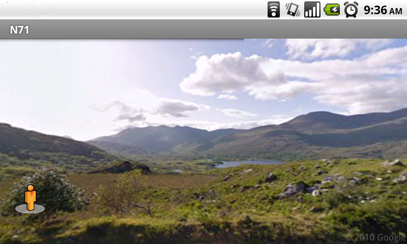
Those interested in learning more should fire up Street View in Google Maps on their mobile phones to take a look at what's new, including beaches of Brazil, the moors of Ireland, or the penguins in Antarctica.
“Today, we’re happy to announce that you can see Street View imagery on all seven continents, with the addition of Brazil, Ireland and Antarctica – specifically, an area called Half Moon Island. Now, you can really explore the world from the palm of your hand,” the company announced.
Those who own a device with support for Street View on Google Maps should launch the app on their phones, and them select a location on the map to view imagery, if available.
The owners of devices running under Android are those to benefit the most from this, since Google Maps for their OS was recently enhanced with Street View smart navigation (more can be found in the video embedded below).
One thing that is certain here is that Google has been hard at work with enhancing the experience it can offer to users via different services it has in store for them.
Street View is a great example in this direction, as the service was launched officially in May 2007, when it offered street-level imagery in five U.S. cities, after which was expanded to cover all continents.
“Three years later, we’re happy to announce that you can now explore Street View imagery on all seven continents, […] You can now see images from around the world spanning from the beaches of Brazil, to the moors of Ireland, to the icy terrain in Antarctica,” Brian McClendon, VP of Engineering, Google Earth and Maps, notes in a post on the company's blog.