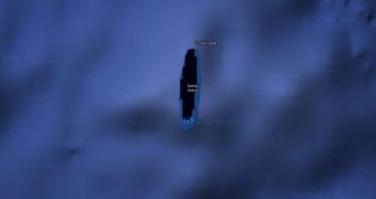
Australian explorers struggle to find a mystery South Pacific island spotted on Google Earth.
The supposition that the spot might be nothing but a Google Earth inaccuracy was eliminated after comparing its images with the ones offered by Yahoo!, Bing and iOS, and even the Times Atlas of the World.
All show the same: “a very dark black island” in the Coral Sea, PhysOrg reports.
However, after a 25-day expedition of the Southern Surveyor meant to search for it, no satisfactory results were obtained.
“We wanted to check it out because the navigation charts on board the ship showed a water depth of 1,400 meters (4,620 feet) in that area—very deep,” declares Dr. Maria Seton, professor at the University of Sydney.
“It's on Google Earth and other maps so we went to check and there was no island. We're really puzzled. It's quite bizarre.”
“How did it find its way onto the maps? We just don't know, but we plan to follow up and find out,” she adds.
The mystery surrounding the unusual island aroused a great interest in social media. One of the posters on ATS says that the given island is a phantom one, due to its having been removed from maps by 1989.
The doubts about the pictured island having a real-life correspondent are being shared by most of the posters.
“Many mapmakers put in deliberate but unobtrusive and non-obvious 'mistakes' into their maps so that they can know when somebody steals the map data,” wrote one of them.
As a response, Google made an explanatory statement for APF.
“We continuously explore(s) ways to integrate new information from our users and authoritative partners into Google Maps,” declared a Google spokesman.
“We work with a wide variety of authoritative public and commercial data sources to provide our users with the richest, most up-to-date maps possible.”

 14 DAY TRIAL //