14 DAY TRIAL //
 NASA has put together some very cool images of the world's vegetation, painting a picture of the globe based on the density of vegetation at any given point.
The images perfectly illustrate the differences between the most arid regions in the world and the greenest ones, both literally and figuratively, like the Amazon basin.
The combined image comes from a year's worth of imagery captured by the Suomi NPP satellite, a collaboration between NASA and the National Oceanic and Atmospheric Administration (NOAA).
"The images show the difference between green and arid areas of Earth as seen in data from the Visible-Infrared Imager/Radiometer Suite, or VIIRS, instrument aboard Suomi NPP. VIIRS detects changes in the reflection of light, producing images that measure vegetation changes over time," NASA explained.
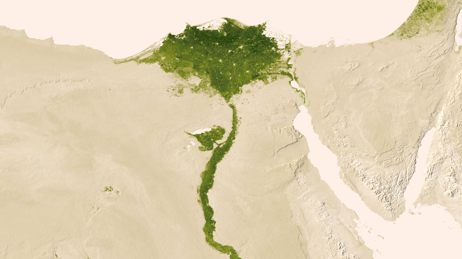
The green globe is cool enough, but things really get interesting when you dive in to see the details, as the imagery is quite beautiful, particularly in places like the Nile Delta.