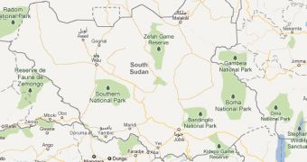
A couple of months ago, the Republic of South Sudan was created. After a long struggle, the republic claimed independence and was recognized by the United Nations. But it was only the beginning of a long process that any new nation must undertake.
Part of that process, as trivial as it may sound, is putting yourself on the map, quite literally. Google Maps has now become the first major mapping service to have updated its data to include South Sudan.
Visiting central Africa in either Google Maps or Google Earth, will reveal the contours of the newly formed republic.
"Following the Republic of South Sudan's recognition as the UN's 193rd Member State, we have updated Google Maps and Google Earth to reflect the new country borders," France Lamy, program manager at Google.org, said matter-of-factly.
Enthusiasts and volunteers, with Google help, got underway mapping the new country even before independence was declared. Now, Google has updated its map to mark the new borders, the capital and big cities.
But there is an effort underway to map in greater detail the entire country using Google's dedicated tool for this, Map Maker.
"Google -- along with the World Bank, UNOSAT, and RCMRD-- is also helping to create better maps of South Sudan by supporting communities who map schools, hospitals, roads, and more with Google Map Maker," Google said.
This will continue until the entire country is mapped accurately, though, since the effort relies on volunteers, enthusiasm will die down as large parts of the country become available.
Still, this exemplifies the strength of the Map Maker program, through it, communities have been able to map regions and even entire countries in no time at all, providing valuable information online.
In fact, the interest is so great in the program that Google is enabling some of the more experienced volunteer map editors to review and approve changes by other contributors.

 14 DAY TRIAL //