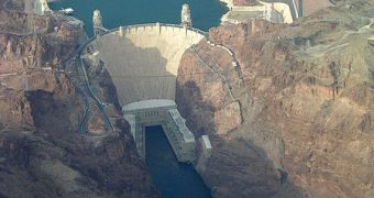
Only time and advanced research can tell if the idea of removing dams is beneficial for both the environment and local communities. The main idea which supports this action is the fact that, once dams get old, their maintenance takes a significant amount of money out of the governments' pockets.
Also, their presence is quite risky, since their failure can lead to catastrophic events. More and more local communities are thinking about abandoning these structures, but authorities say they are dealing with a hard call, which implies several risks of great proportions.
"A lot of communities now are trying to wrestle with the decision of whether or not to support dam removal. And part of that uncertainty is our lack of scientific knowledge of what's going to happen when you take a dam out," stated Frank Magilligan, from Dartmouth College.
One of these constructions which faced removal is the Homestead Dam, a 200 year-old structure no longer needed, built along the Ashuelot River in Swanzey, N.H.
It was taken down in July 2010, and a year after, researchers managed to highlight the benefits and risks of such a measure, applying them to similar operations which might be developed in the near future.
Researchers are now able to estimate the consequences of a dam removal process, using their LIDAR technology.
"LIDAR is a very sophisticated laser system. What [we're] able to do is pick up very detailed, centimeter-scale topographic elevation," declared Magilligan.
The system can come up with realistic data in less than a few hours, providing exact information about the river's flow for any period of time and being able to reduce the time frame required by ground surveillance methods.
Scientists are also able to determine how the path of the river was deviated, applying the centimeter-scale topographical informations obtained while using a GPS device.
While comparing data gathered during the last days of the dam and a year after the Homestead Dam was removed, Magellans says a few visible changes have been spotted.
"What we have seen from some of our field analysis is that there's been a couple of feet of bank erosion in some places. In other places, we see a couple of feet of bank deposition as well," concluded the researcher.
In his opinion, modern technology can tell the local community if removing an ancient, useless dam would be an effective, risk-free operation. Knowledge is power once again, and if authorities are aware of how the river flows, the entire process shouldn't affect the safety of people living in that particular area.

 14 DAY TRIAL //