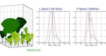
Using a technique called polarimetric information in Synthetic Aperture Radar (Pol-InSAR), satellites belonging to the European Space Agency (ESA) are now able to conduct a series of advanced investigations, including determining the three-dimensional structure of forests.
At the same time, the approach can be used to map forest height, and to discover natural or anthropogenic (man-made) disturbances among the trees. All these datasets have extremely high levels of spatial resolution and accuracy.
There are several reasons why these satellite radar data are valuable. Applications range from forest management and protection to counter-terrorism, to name but a few. In addition, scientists may be able to gage the amount of carbon dioxide that vegetation takes out of the atmosphere in more detail.
This means that spacecraft featuring Pol-InSAR instruments could become important assets, capable of assessing Earth's carbon cycle and CO2 stocks, as well as monitor other critically-important resources.
The remote-sensing technique works by sending polarized radar pulses towards a target and then analyzing the information contained in the backscattered radiations. The 3D effect is obtained by snapping two polarimetric SAR images of the same area, but from slightly-different angles.
“By deriving information on the tree canopy height and vertical structure, forest biomass can be estimated. The biomass of places like tropical forests are crucial for storing carbon, and large areas could be mapped very accurately using this technology,” ESA experts say in a press release.
“In recent years, the potential of Pol-InSAR techniques for the estimation of forest structures has been addressed, developed and matured through various ESA-funded research and development studies,” the statement goes on to say.
Forests, especially in tropical ecosystems, are of extreme importance for Earth's carbon cycle, and for the way the element is stored. Oceans also play a huge role in trapping CO2 from the atmosphere, and storing it in deep deposits.
ESA has been using SAR images to conduct such studies for a long time. At this point, the organization is interested in refining the technique, and using it for increasing numbers of practical applications.

 14 DAY TRIAL //