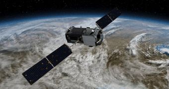
Officials with the American space agency are currently getting ready to launch their new Orbiting Carbon Observatory-2 (OCO-2) satellite, which will study the Earth's carbon cycle in extreme detail. The spacecraft is the successor of the doomed OCO satellite, which was lost at launch 5 years ago.
The first vehicle in this series took off from Launch Complex 576E (LC-576E) at the Vandenberg Air Force Base (VAFB) in California, aboard a Taurus-XL 3110 delivery system provided by Dulles, Virginia-based Orbital Sciences Corporation (OSC). The payload fairing did not successfully detach from the spacecraft during the ascent, so the satellite could not reach orbit due to the extra mass.
OCO eventually reentered Earth's atmosphere and burned high above the surface. Debris fell over a wide area in the Indian Ocean, close to the coastlines of Antarctica. NASA began working on OCO-2 the next fiscal year, and the replacement is currently ready to fly into orbit. This is one of the five new missions the American space agency will launch this year.
Though NASA initially wanted to launch the new mission aboard the Taurus XL rocket, both the agency and OSC decided in 2011 to cancel that contract. This delayed the satellite's launch to this year. NASA eventually decided to go with the Delta II rocket developed and built by the United Launch Alliance, one of the most feasible and successful delivery systems in the word.
VAFB was again selected as the launch site for the mission. The Delta II rocket is scheduled to insert OCO-2 into a 705-kilometer (438-mile) polar orbit, a vantage point that will enable the sensitive instruments aboard the spacecraft to collect around 8 million measurement points every 16 days.
All these data will then be combined to create a map revealing the global distribution of carbon dioxide (CO2) in Earth's atmosphere. The project is being coordinated by experts with the NASA Jet Propulsion Laboratory (JPL) in Pasadena, California. JPL expert Ralph Basilio is mission manager.
“Right now, the land and the ocean are taking up almost half of the carbon dioxide we add to the atmosphere by burning fossil fuels, but the future is fundamentally unknown. OCO-2 is a key to getting answers,” explains California Institute of Technology (Caltech) professor of atmospheric chemistry Paul Wennberg.
One of the most interesting things about CO2 distribution is that it becomes uniform throughout the atmosphere in a matter of months. However, this only applies to carbon dioxide that is not captured by forests, oceans, or special types of rocks. What OCO-2 will do is create a map of how carbon is absorbed by natural sources, and how that material is being distributed across the world.
The new satellite will also be one of the first orbital assets capable of detecting when forests cross the line from carbon sinks to carbon sources. While trees and vegetation usually absorb carbon, they also release vast amounts of the greenhouse gas during wildfires, or when they are cut down.
“With atmospheric carbon dioxide at unprecedented levels, our sense of urgency has only increased. What will happen if we keep emitting carbon dioxide at the same rate? The ultimate goal for OCO-2 is to provide data so that organizations and individuals throughout the world can make better-informed decisions about carbon,” Basilio concludes.

 14 DAY TRIAL //