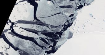
This new image from the Advanced Land Imager (ALI) instrument aboard the NASA Earth Observing-1 satellite shows a portion of the East Antarctica coastline. Numerous types of ices can be seen in these images, which also depicts water that appears black from above.
This happens because water from melting ice is a lot darker than surrounding water. In turn, this contributes extensively to the feedback cycle that is promoting ice melt at both poles.
The ALI image shows a large number of ice fields and glaciers in the right-hand side of the image. On the left, melt channels, floating icebergs and crumbling ice sheets are clearly visible as well.
However, the data also shows tiny crusts of ice that are just now forming. This is an encouraging sign that the Antarctic ice sheet might regain some of its lost ice masses this year.

 14 DAY TRIAL //