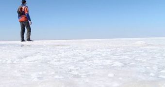
Measurements of the spectral reflectance of several square kilometers of salt in Tuz Gölü (Lake Tuz) in southern Turkey, from 14-25 August, should improve satellite based Earth observation as well as our understanding of the climate.
Tuz Gölü is like any regular lake throughout the year, except for the months of July and August, when it turns into a bright, pure, white surface that is perfect for calibrating Earth's observation satellites.
It was recently approved by the Committee on Earth Observation Satellites (CEOS) as an international standard for evaluating satellites' sensor-to-sensor biases and also calibrating their radiometric performance.
This is a rather big event as the CEOS reference standards sites need to have their radiometric features constantly evaluated and traceable to SI Units, and the National Physical Laboratory (NPL), with funding from the European Space Agency and from the National Measurement Office, has made serious international efforts to achieve this.
Because satellite sensors suffer degradations in space, it is rather difficult to trust pre-flight assigned values of their radiometric characteristics and measurements of small changes of the planet become challenging.
This exercise will start with laboratory calibrations of all instruments to NPL standards, that will be followed by 9 days of testing at Tuz Gölü, as temperatures rise to 50°C and allow experts to measure the reflectance of several test-sites.
Along with these ground measurements, a range of satellites will analyze the same site as an evaluation of their performances.
As leader for this comparison, NPL will also measure the salt lake's surface reflectance from several angles using the Gonio-Radiometric Spectrometer System (GRASS), as this will allow correcting satellites that do not view the lake from directly overhead.
This is just the beginning for an operational calibration service for Earth's observation sensors and, in the long run, measurements of the eight reference sites will be done automatically as they will be linked as a network (LandNET) that will adjust signals to match the different response and geometric conditions of every one of them.
Finally the characteristics of the site will be calibrated from orbit by an in-flight standard sensor, like the NPL TRUTHS mission for example.
All this is part of a vision of a Global Earth Observing System of Systems – GEOSS, that will be able to monitor agriculture, resources and disasters continuously, thanks to data link between different satellites.

 14 DAY TRIAL //