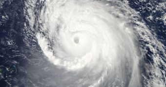
Officials managing the European Space Agency's (ESA) Earth Explorer constellation say that an innovative microwave radiometer aboard the Soil Moisture and Ocean Salinity (SMOS) satellite is helping the spacecraft contribute to hurricane forecasts.
The spacecraft was developed for measuring ocean salinity and soil moisture levels, so the fact that it can be used to track down hurricanes via the microwave instrument came as an impressive bonus.
The reason why that instrument is present aboard the spacecraft is that it is extremely effective at capturing images of “brightness temperatures,” which are amounts of radiation that are emitted by the very surface of our planet.
By monitoring how these temperatures change, SMOS is apparently able to derive the paths and intensity of developing tropical storms, investigators say. The type of information the spacecraft can provide is unique, which means that scientists may now use it as part of larger models.
However, the most important implication is that we now have a new window of research into Earth's water cycle. Understanding the processes associated with this cycle is vital for developing accurate weather forecasts and climate change models.
The L-band microwave sensors aboard SMOS operate in a narrow frequency range focused on 1.4 GHZ. This enables it to observe the speed of surface winds even when its target areas are covered in clouds or severe precipitations.
Oceanographers say that increased wind speeds over the ocean can lead to the whitecap effect, as well as to the breaking of waves. Both of these effects contribute significantly to changing the microwave radiation patterns being released by the water. SMOS is very sensitive to these shifts.
“SMOS has also achieved another success: it has shown that salinity in the surface waters change in the wake of a hurricane. This is the first time that such changes have been detected from space,” ESA says in a statement.
“The combination of salinity data from SMOS with sea-surface temperature and sea-surface height information will improve the monitoring of fresh and warm water in relation to hurricane intensity,” the document adds.
Finding out that SMOS can also track hurricanes is only the latest in a series of similar discoveries that ESA made of its own spacecraft, particularly those in the Earth Explorers series. All of them were created for specific objectives, but proved capable of conducting additional studies on the side.

 14 DAY TRIAL //