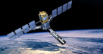
The year debuted with a very dry spring for Western Europe, climate experts said a little while back, and this was also confirmed by orbital readings taken by a dedicated satellite. Its maps show the vast difference between readings collected in 2010 and 2011 over the same areas.
The Soil Moisture and Ocean Salinity (SMOS) mission, which is managed by the European Space Agency (ESA), is the most advanced spacecraft of its kind ever created. It can survey the entire glob once every couple of days.
It features a tremendously-sensitive suite of scientific instruments, which aid it in measuring soil moisture with extreme precision. All validation studies conducted on the ground verified its data.
Data such as those supplied by the SMOS are very important for agricultural and hydrological applications, experts say. Improving these fields throughout Europe is one of the main reasons why the spacecraft was created in the first place.
What;s interesting to note here is that the satellite is already helping long-term agricultural planning, although it has only been in orbit for around 18 months. Its data help experts understand how Earth's surface and its atmosphere interact.
“The maps of France, generated by CESBIO using SMOS data, show a clear difference between April 2010 and April 2011 in the amount of moisture present in the soils. The blue and green colors represent wetter and the yellows show drier surfaces,” ESA experts say in a press release.
“Prior to the launch of SMOS, there were relatively few global datasets on soil moisture. However, now the mission is filling this gap, along with valuable datasets on ocean salinity,” the document adds.
“Soil moisture is a critical component in temperature, humidity and precipitation forecasts and the objective of the SMOS mission is to provide a global image of surface-soil moisture every three days,” the release reads.
“These data, together with numerical modelling techniques, result in estimates of soil-water content down a depth of one to two meters,” the team explains further, adding that the world's soils play a critical role in the planet's water cycle.
Understanding this cycle is one of SMOS' long-term goal, ESA explains. This could in turn help predict agricultural yields, precipitation patterns, and could also contribute to a better understanding of how global warming will change the planet's climate.

 14 DAY TRIAL //