Google Maps started out as a simple tool to bring maps online, but it has evolved well beyond that, due to the big opportunities and capabilities of the web. One thing that makes the map more useful and more interesting are 3D buildings.
Google has been working on adding 3D data and models for years now. You can see plenty of beautiful buildings and historical sites recreated in 3D in Google Earth and Google Maps Earth View.
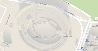
But 3D buildings are also visible in the regular version of Google Maps and they provide some context to the plain 2D layout. Having the buildings represented in three dimensions on the map makes it easier to navigate places you've never been to or a complicated area.
Now, Google is adding 3D buildings to a lot of US and European cities, expanding on the number of places where the feature had been available previously.
"Google Maps continuously works to bring you real-life 3D representations of your favorite cities from around the world. Google Maps in 3D combines a functional map with stunning visuals," Google explains.
"You can tour an increasing number of cities in 3D and experience the streets and sights right from your computer or Android device," it said.
"Since embarking on our 3D mapping efforts, we have amassed a collection of cities that allows you to feel like a jet-setter. We have recently expanded and improved this collection to include more cities in Europe and the US, to name a few," it announced.
Here's the full list of new cities now available in Google Maps with 3D buildings. In the US: Foster City, Honolulu, Las Vegas, Norfolk,Palo Alto, Portland, Redwood City, Riverside, Salt Lake City, San Antonio, San Diego, Santa Cruz and Sunnyvale. In Europe: Rome, IT; Rotterdam, NL; Seville, ES; Stuttgart, DE; Amsterdam, NL.

 14 DAY TRIAL //