One of the most useful data in Google Maps is real-time or close to real-time traffic data. Access to it ensures that motorists know which routes to take, either to get to their vacation spots or to for their daily commutes.
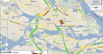
Now, road traffic data is available in Google Maps in Sweden and Taiwan, ensuring users in these locations save time and fuel by finding the less clogged alternative route.
"When you turn to Google Maps to get from A to B, we want to help you find the quickest way to get there. Knowledge about the current traffic conditions on the roads can help you determine when to set out on your journeys and which routes to take," Paul Constant, Software Engineer at Google, wrote.
Road conditions data is already available in much of Europe, the US and some parts of Asia, mainly in China. It's fairly limited in some locations, but it can still be useful.
"With this in mind, we’ve just expanded our coverage of traffic information on Google Maps to include Sweden and Taiwan," he announced.
"Users in both places can now check the latest on road congestion with their desktop browsers or mobile phones. The traffic information covers all major thoroughfares as well as arterial roads in select cities," he explained.
Traffic data for major roads and highways is easier to obtain, so in many countries, including the two new locations, it's this data that is mostly available.
In some locations though, in places where there are enough people using Google Maps for example or where there are other reliable ways of getting traffic data, arterial roads inside cities are also covered.
For the places that offer traffic data, you will be able to display it in Google Maps by selecting the "Traffic" layer. The color coding is fairly intuitive and all of this data is available for mobile devices as well.

 14 DAY TRIAL //