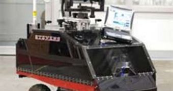
A robotics convention saw last week the introduction of a new vehicle able to perform on-the-go 3D measurements and maps of a certain area. The new machine, called ROAMS, was built from commercially available, off-the-shelf parts, with funds provided by the US Army. The Remotely Operated and Autonomous Mapping System was devised by scientists at the Stevens Institute of Technology, in Hoboken, New Jersey.
The new system was presented at the IEEE conference on Technologies for Practical Robot Applications, held in Woburn, MA. It was demonstrated that the small vehicle could accurately reconstruct its surroundings, and build 3D color maps representing them. The “active” component of the new system is the 2D LIDAR sensor that is mounted atop the small vehicle. Unlike a conventional 3D LIDAR system, which can cost as much as $100,000, the 2D variety is only $6,000, which means that a lot more people and agencies will afford to buy a ROAMS system.
The challenge that the research team had to face was using its cheaper LIDAR system in a way that mimicked the functionality and results of the more expensive variety. In the end, it managed to devise a number of settings that allowed the device to become suitable for low-cost architectural surveying, and military map-making. For combat situations, the amount of detail ROAMS provides is more than enough, the SIT team reveals. “The prototype system is around $15,000 to $20,000,” Stevens research engineer Bilge Gebre adds, quoted by Technology Review.
The vehicle's demonstration showed that it was perfectly able to image and map an area 160 meters wide in just 30 seconds. A rotating camera also moves with the LIDAR, thus allowing for color images to be added to the laser readings later on. The scanning process is automatically adjusted depending on the proximity of the objects being studied, the team adds, so that the same resolution is maintained throughout the observations. “We want to leave this robot in a location and ask it to generate a complete map,” Stevens Design and Manufacturing Institute Professor and Director Kishore Pochiraju shares.

 14 DAY TRIAL //