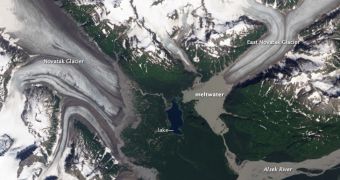
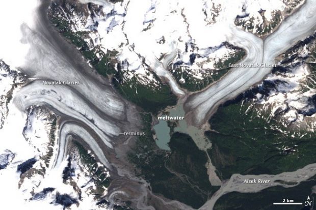
This past August 14, NASA (the US' National Aeronautics and Space Administration) released two photos documenting how two of Alaska's glaciers have transformed over the past few years.
One of these photos was taken by the Landsat 8 satellite last year, on August 13, and is available next to this article. You can find the other one, obtained on August 22, 1987, with the help of the Landsat 5 satellite, below.
As one can easily notice, the two glaciers, identified as Novatak and East Novatak, shrunk by a considerable extent between 1987 and 2013. Thus, they retreated by 0.6 miles (1 kilometer) and 1.2 miles (2 kilometers), respectively.
“Novatak and East Novatak glaciers, located just a few kilometers apart near the outlet of the Alsek River, are two of many retreating glaciers in southeastern Alaska,” NASA writes on its website.
“This pair of satellite images illustrates how much both glaciers changed over a 26-year period and how that change affected the lake between them,” the Administration goes on to explain.
What NASA means is that, as a result of changes in the surface area of these two glaciers, the lake in their proximity stopped having ice melt and rock flour delivered to it and turned dark blue. Its shape was also altered.
As explained by specialists with the Administration, these two glaciers are fueled by snow falling at higher elevations. Thus, investigations have shown that the snow reaches the glaciers after compressing into ice and moving down through local valleys.

 14 DAY TRIAL //

