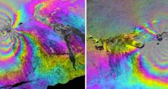
A team of scientists was recently able to image the magma chamber underneath the Mount Kilauea volcano, in Hawaii. In order to do that, the experts never had to install measuring equipment of the mountain's slope or dig their way deep underground, but rather soar high in the sky above it.
Using a special type of radar-based technology developed by experts at the NASA Jet Propulsion Laboratory (JPL), in Pasadena, California, the research team was able to conduct airborne studies of the mountain's interior from more than 41,000 feet (12,500 meters) above it.
The purpose of such an investigation was to measure the amount of magma inside Mount Kilauea. Knowing this is very important if geologists are to make any kind of prediction about how likely the mountain is to erupt. This particular volcano has several calderas.
In fact, one of its vents has been releasing magma and gases continuously for the past three decades. This year represents an anniversary of sorts for that particular caldera, but scientists are not taking this lightly. Even if pressure is constantly being vented from the volcano, there is still a chance it will blow.
In order to figure out how magma is moving deep within its underground chambers, researchers are using the Uninhabited Aerial Vehicle Synthetic Aperture Radar (UAVSAR) technology to measure how the ground gets deformed by the motions underneath. This is the third time the team comes to Hawaii.
“There's always something going on. Usually even if it's not having a specific eruption it's usually following an eruption or about to erupt, where you're having some surface deformation going on,” explains JPL geophysicist and mission leader Paul Lundgren, quoted by Space.
He explains that NASA allowed the team to use an aircraft based at the Dryden Flight Research Center, in Edwards, California. The G-III research aircraft is outfitted with a belly pod that carries the UAVSAR instrument, originally developed for satellite studies.
The microwave interferometry it uses to conduct its studies is so precise that it can detect the most minute deformations of the ground. Complex algorithms are then used to create connections between the underground magma movement patterns and the likelihood of a major eruption.
The more the team analyzes this volcano, the more likely investigators will become to figure out how far we are from another eruption at Mount Kilauea.

 14 DAY TRIAL //