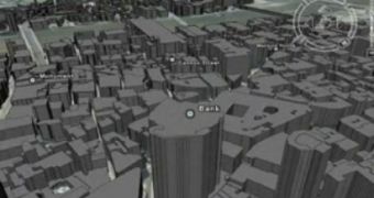
After years of working on a virtual London to be included in Google Earth, the Ordnance Survey rejected the demand issued by Google and the group of designers to add a new 3D drawing to the famous downloadable mapping tool. It seems like the Mountain View company negotiated with the British organization several times but they failed to sign a deal. According to Digital Urban, the 3D version of London includes no less than 3 million buildings placed just like in the real city. The Ordnance Survey published an official statement to reveal the reason for the rejection.
"We provide an open, fair and transparent set of terms for providers seeking to operate in the same commercial space as each other. We cannot therefore license Google in a different way to other providers. We are completely supportive of anyone putting our data on the web as long as they have a license to do so. Regarding the reference to Haringey, it is not the building of the model that is the difference - it is the use," the message reads as Digital Urban reports.
At this time, there isn't much to do about it because without the Ordnance Survey's approval Google cannot update the mapping solution with 3D imagery of London.
"We have had dialogue with Google concerning commercial licensing issues around our data in CASA's Virtual London model. There are differences in what Google wants and what our licensing framework permits that mean we have not been able to reach agreement," it is also mentioned.
This is very bad news not only for the fans of Google Earth but also for the Internet users from every corner of the world as well as for residents of the city who are looking for a powerful solution to offer what the virtual London would be able to provide.

 14 DAY TRIAL //