 14 DAY TRIAL //
 At this time, Google Earth is probably the most widely used application in its category because it allows users to view maps and other imagery with the entire world captured directly from the satellite. Google Earth is currently a powerful rival for Microsoft's Virtual Earth, a similar application that provides almost the same features as Google's product. The search giant also designed Google Maps, a web based version of the Earth program that helps you view maps and photos from the satellites using a simple website and a clear interface. The company improves them periodically with new exciting features to keep the products in the spotlights and to attract more users.
The latest update added to the program is a Google SketchUp interoperability that helps users design their own 3D models of buildings, streets and cities to include them into the Google Earth application. Although the company is now aiming to develop a powerful 3D imagery program, it seems like other developers are already working for an innovative tool that will surely challenge the product developed by the search giant.
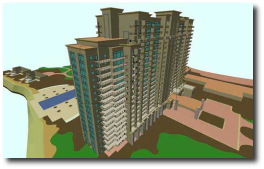
Multiple Shanghai developers are currently designing a new tool that will allow users to view 3D imagery with buildings that are captured using a helicopter equipped with a well developed 3D mapping technology. The helicopter will fly over certain locations, capture images and then transfer them for processing to be included into the final application.
"We can create vivid digital maps with this system. Users will feel like they are hovering above a place when they look at the map," Shu said. "For example, we can design a 3D map for the World Expo park. With the aid of a webcam, users can get vivid pictures of a specific area - what the surroundings are like and whether a place is crowded," ChinaDaily reported.