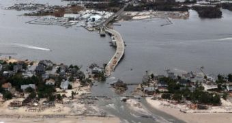
While American citizens living on the US East Coast are still busy trying to make head and tail of hurricane Sandy and its impact on both urban and rural areas, meteorologists warn that, this coming Wednesday, New York and New Jersey could be hit by a new storm.
This new storm is a “Nor'easter,” and will come up along the Atlantic coast, specialists explain.
Although this second storm will not by any means match hurricane Sandy's aggressiveness, the fact remains that both these two American states have been severely impacted by the recent Frankenstorm, and are therefore vulnerable to any similar weather manifestations.
According to the New Jersey Newsroom, several of the people inhabiting the New York metropolitan area and the New Jersey coastline still lack access to electricity and have to make do with limited amounts of heating oil and gasoline.
This means that, should a new storm hit these areas, most of them will be left with no choice but to face the low temperatures on their own.
Moreover, meteorologist Bernie Rayno warns that the New Jersey coast could potentially witness severe floods, seeing how it has already been eroded by hurricane Sandy.
“There are dunes that have been eroded away completely, so now their protection is gone. That will make these communities more vulnerable to future storms that may not be as strong,” a research oceanographer told Our Amazing Planet.
The same source informs us that in the case of this new storm expected to hit the US on Wednesday, the gusts could reach the speed of 55 mph (88.5 kph), and the strongest winds will most likely hit Long Island.
“I think by far the worst impact will be the coastal flooding and erosion, and that's a concern regardless of how far off the coast it is.”
“You'll get pretty strong winds and enhanced swells and waves. I think that's looking pretty certain,” weather researcher Brian McNoldy stressed.

 14 DAY TRIAL //