A NASA C-20A airborne science aircraft and support crew took off from the American space agency's Dryden Aircraft Operations Facility in Palmdale, California on Tuesday, January 28, carrying a high-precision radar instrument provided by the Jet Propulsion Laboratory (JPL), in Pasadena.
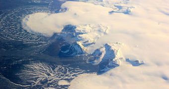
The aircraft is heading for Iceland, where it will be used to conduct a series of four scientific flights over the small island's glaciers. The goal of the expedition is to analyze how these ice fields move and evolve during the northern hemisphere winter.
Such studies are very useful for glaciologists and climatologists, who thus get a chance to study some of the most basic processes associated with the melting of glaciers. This phenomenon is one of the most significant contributors to rising sea levels, a process caused by global warming and climate change.
The Uninhabited Aerial Vehicle Synthetic Aperture Radar (UAVSAR) was developed at JPL, and is managed by California Institute of Technology (Caltech) geophysics professor Mark Simmons. Caltech graduate student Brent Minchew is also a part of the control team.
This instrument was first used in Iceland in June 2012, when the flow of two ice caps, called Hofsjökull and Langjökull, was analyzed during the summer. These formations are made up of several individual glaciers, each flowing at a different speed and in a different direction. This makes the ice cap duo the perfect natural laboratory for studying variations in glacier melting rates.
The Caltech team hopes that cross-referencing datasets from this winter and last summer will enable them to pinpoint the exact role that meltwater plays in promoting glacier melting. Meltwater is produced by the summer sun, and then goes on to bore holes through the glaciers, until it reaches the bedrock underneath.
Once it infiltrates under the ice, these waters lubricate the bedrock, allowing ice to flow faster over asperities on the ground. Understanding this process could lead to more accurate predictions of how sea levels will rise over the coming decades.
“That's a challenging subject. Our understanding of the effects of meltwater on glacier flow is by no means complete. Even the most sophisticated ice sheet models probably are not capturing all of the salient processes,” Minchew explains.
The current expedition to Iceland will last from January 30 to February 6. All flights will be carried out during the very short days present at such high latitudes, and will replicate the flight paths taken during the study conducted in the summer of 2012.
“We are benefiting from a huge amount of work on these glaciers that's already been done by a group of internationally recognized glaciologists in Iceland,” Simmons adds.
“The glaciers are in their backyard, and they've been studying them for years. They've already mapped the ice-rock interface at the bottom of the glacier, for example. We've had nothing but support and encouragement from them,” he concludes.

 14 DAY TRIAL //