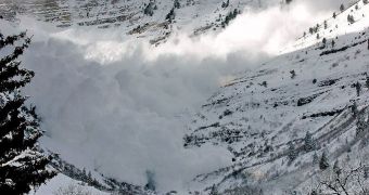
A new tracking system that holds great promise in saving future avalanche victims has just been developed in Germany. The method, which was created by scientists at the Fraunhofer Institute for Material Flow and Logistics IML, will rely heavily on the future European satellite navigation system, Galileo. The team reports that its method will be able to pinpoint everyone carrying an avalanche transceiver or a cellphone, with a spatial resolution of just a few centimeters. This could provide search and rescue teams with a lot of help, and could increase victims' chances of survival, PhysOrg reports.
When trapped under an avalanche's debris field, people can only hope that someone starts digging for them soon. They need to be extracted within the first half an hour, otherwise their chances of survival diminish rapidly, and they perish under the snow. The key to a successful rescue is the avalanche beacon, which usually allows rescuers to pinpoint their location. “In the experience of rescue teams, not everyone actually carries beacons,” IML expert Wolfgang Inninger says.
“However, nearly everyone has a cellphone. This is why we decided to enhance our automatic geolocation system that works with Galileo, the future European satellite navigation system,” he adds. In order for this approach to work, Inninger reveals, the ARN (avalanche rescue navigator) system needs to receive two new functions. The first one is the ability to locate cellphones, and the second is a piece of software that needs to be able to calculate the victims' positions relative to the local environment. The system will also be able to calculate the exact distance between the victims' locations and the nearest rescue team, so as to minimize the response time.
For this amazing research, the team uses the GATE Galileo test and development environment, which is a gigantic research platform that simulates incoming signals from the future Galileo network. Six antennas are installed on just as many mountaintops, and all of them act like a member of the future satellite constellation. The goal of Europe's future grid will be to provide an alternative to the American GPS and the Russian Glonass. Member states of the EU will benefit from the advantages of the new satellites at smaller prices than if they were using the US variety.

 14 DAY TRIAL //