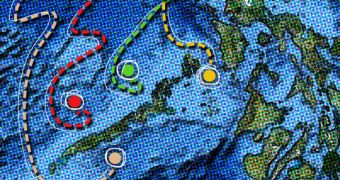
Early on in school, we are told that the shortest distance between two points is a line. There are some cases though, where this is not true, and navigating underwater is one of them. A team of experts at MIT announces the creation of an algorithm that provides efficient transportation routes underwater.
The new calculations are primarily destined for unmanned swarms of submersible robots. Traveling from point A to point B underwater is a lot trickier than doing so on land, primarily because of the extra factors that come into play.
Strong and shifting currents can easily throw a ship or submarine off course, even if the vessel is traveling on the shortest, most efficient path. Under these circumstances, making a small detour from the optimal route could have its advantages.
When the MIT group took on this task, they were not only content with finding a way of allowing a single unmanned submarine to get to its destination safely and efficiently, they also sought out to discover how they could make an entire fleet of such robots do the same.
The issue then became significantly more complex, but the research group eventually managed to overcome all issues. The new algorithms are the result of this effort. The swarm of vessels they control can even be made to travel towards different destinations.
Details of how the approach functions will be presented in May at the annual IEEE International Conference on Robotics and Automation. The group was led by the MIT Doherty Associate Professor in Ocean Utilization, Pierre Lermusiaux.
Given the growing presence of automated underwater vehicles (AUV) in the world's ocean, such an algorithm could really make a difference in the way these vehicles travel, on how much resources they consume to move around, on how much time it takes to do so, and so on.
Credit goes to the MIT group for developing a section of the algorithms that deals with how AUV should navigate complex shorelines and strong shifting currents, areas that are by definition very dangerous.
“Because ocean environments are so complex, what was missing was the integration of ocean prediction, ocean estimation, control and optimization” for planning paths for multiple vehicles in a constantly changing situation,” Lermusiaux says.
His MIT Multidisciplinary Simulation, Estimation, and Assimilation Systems (MSEAS) group has now developed this integration tool, which is ready to be deployed in field tests right away.

 14 DAY TRIAL //