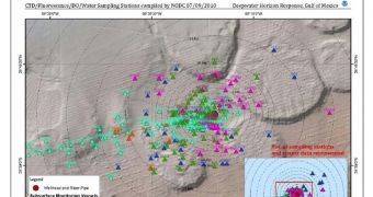
Since April 20, the area around the site of the former BP-operated Deepwater Horizon drilling rig has been under the influence of heavy contaminants. Countless barrels of oil have spilled into the water of the Gulf of Mexico, and federal agencies in the United States have been keeping an eye on the situation ever since. Just recently, the US National Oceanic and Atmospheric Administration (NOAA) released its second peer-reviewed, analytical summary report about subsurface oil monitoring in the Gulf.
The work was conducted in collaboration with colleagues from the White House Office of Science and Technology Policy (OSTP), and was released yesterday, July 23. The two governmental agencies collaborate through a body known as the Joint Analysis Group, which is meant to facilitate communication and information-sharing. The new report is basically a new tool to keep track of other subsurface oil plumes that may exist in the waters of the Gulf.
The samples on which the conclusions were based come from about 227 sampling sites spread around the area of the spill. These stations can be found between 1 and 52 kilometers away from where the semi-submersible drilling rig sunk. The new document confirmed the conclusions of the first report, which showed that contaminant concentrations were decreasing as distances increased from the accident site. The spread of subsurface oil is also consistent with existing marine currents, JAG experts write in the document.
“The Joint Analysis Group is working to ensure the vast amounts of data being collected in the Gulf are compiled, synthesized and analyzed in a comprehensive manner. This is the best way to ensure the Unified Command is benefiting from a full understanding of the available information, and that relevant findings and lessons are being shared with the responders as well as the broader research community,” explains the head of JAG, NOAA Chief Scientist for Fisheries Steve Murawski.

 14 DAY TRIAL //