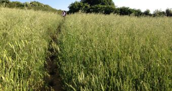
Scientists at NASA acknowledged a long time ago the necessity of conducting more global food security studies, whose conclusions must be used for informing policies and developing mechanisms of ensuring that the world does not starve. A recent effort to map vast swaths of Earth's croplands reflects the agency's commitment to this goal.
The new effort is focused on mapping no less than 3.7 billion acres, or 1.5 billion hectares, of croplands from around the world. This represents around a third of the world's surface, which is roughly the amount used for agriculture today.
The goal of the experiment is to determine which soils are fertile and where they are located, identify what types are grown and where, and to figure out if these lands are irrigated artificially or via rains. These are all data of paramount importance for creating projections of future food security.
In addition to compiling a wealth of satellite data on these areas, NASA will also have to use special software to make this study feasible. James Tilton, a computer engineer at the NASA Goddard Space Flight Center (GSFC), in Greenbelt, Maryland, may have a solution to this problem.
The expert is already working on a piece of advanced software for another project at the space agency, but his efforts will also be adapted for the NASA Making Earth System data records for Use in Research Environments (MEaSUREs) program.
“The idea of this project is to have an accurate cropland data set. Ultimately, it will help provide a better accounting of water use, cropland productivity, and water productivity – all critical information for studying global food security,” says expert Prasad Thenkabail.
He holds an appointment as the principal investigator of the MEaSUREs project at GSFC, and is also a geographer with the US Geological Survey (USGS), in Flagstaff, Arizona. The expert estimates that this project will require about 5 years to complete.
The software Tilton is developing will be used to turn the 1s and 0s returned by satellites such as those in the USGS Landsat constellation into viable maps. These spacecraft have the ability to identify precisely what each terrain they are surveying is used for.
“The satellite platforms offer an opportunity to look at the entire world in a unique way. It has no bias,” Thenkabail concludes.

 14 DAY TRIAL //