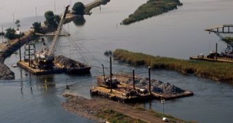
Scientists at NASA argue that their Uninhabited Aerial Vehicle Synthetic Aperture Radar (UAVSAR) instrument could be used to monitor the aging levees in California and in other parts of the country. This discovery was made by accident in 2008, during a flight over the Sacramento River delta by the NASA C20-A aircraft that houses the instrument.
Inside the aircraft was NASA Jet Propulsion Laboratory (JPL) research scientist Cathleen Jones. The purpose of the flight was to investigate the famous San Andreas fault near San Francisco but, as the plane took a turn, the expert noticed the patchwork of levees criss-crossing the low-lying land below.
She immediately realized that the extreme sensitivity of the UAVSAR instrument could be used to measure even minute displacements in these aging levees. An estimated 1,770 kilometers (1,100 miles) of levees were built over the years in the Sacramento River delta alone. All of these structures are currently decaying, and pose flood hazards to surrounding areas.
Back in 2004, a single levee break caused around $90 million (€65 million) in property damage. According to the results of the ensuing investigation, a single beaver was responsible for the entire catastrophe, having drilled a hole through the levee with ease. Monitoring these structures via the NASA radar could prevent such events from occurring in the future.
The UAVSAR instrument has a resolution of about 0.1 to 0.5 centimeters (0.04 to 0.2 inches), meaning that it can detect ground movements smaller than half an inch, or less than a centimeter. A beaver digging a hole in the ground would create a larger displacement than that, allowing scientists to identify areas that may pose hazards right away.
“It struck me that this new instrument might be perfect for monitoring movement of levees,” Jones said. The next logical step was to contact water managers with the California Department of Water Resources (DWR), and present her idea. The agency was highly interested because many of the dirt levees in California date back to the Gold Rush.
An estimated 4 million acres of farmland rely on irrigation systems fueled by water from the delta. Additionally, around 67 percent of all people in the state rely in drinking water from the same source. Searching for tiny soil deformations could give authorities the early warning they need to avoid any potential disruption in irrigation or fresh water supply in California.
“UAVSAR has the highest potential for giving us a very precise measurement at a scale that we didn't know was possible. During high water we drive the levees, watching for leaks, but if there's a lot of vegetation or it's dark, we may not be able to see them,” says Joel Dudas.
“If we could fly this instrument during a flood, it would allow us to direct our emergency vehicles where they need to go. If this work saves even one levee failure, that's more than worth all the time and energy we've put into it,” adds Dudas, a senior water resource engineer at DWR.

 14 DAY TRIAL //