For the first time in recorded history, thin seasonal ice has replaced ancient ice as the dominant form of frozen water around the North Pole, a new survey by NASA shows. Using measurements from its Ice, Cloud and land Elevation Satellite (ICESat), the American space agency has proven that the most dramatic changes occurred between 2004 and 2008, when the balance between the two types of ices drastically shifted. These results essentially imply that the ice meltdown that happens each summer takes up more of the ice sheets than freezing adds during the winter season. As a result, the ice caps are constantly shrinking, and will continue to do so, as long as global warming exists.
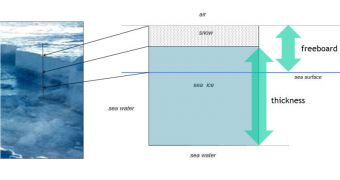
Ice in the Arctic builds up during the winter, as more and more water freezes and forms sheets. But, during the summer months, the natural tendency is for prevailing winds and currents to dislodge some of it out in the open sea and melt it. At this point in time, the ICESat readings show, the two-foot-thick seasonal ice is constantly replacing the nine-foot-thick multi-annual one, causing the overall volume of the ice cover to drop. The new ice is also more prone to melting, and cannot withstand the temperatures that the older one can.
“Ice volume allows us to calculate annual ice production and gives us an inventory of the freshwater and total ice mass stored in Arctic sea ice. Even in years when the overall extent of sea ice remains stable or grows slightly, the thickness and volume of the ice cover is continuing to decline, making the ice more vulnerable to continued shrinkage. Our data will help scientists better understand how fast the volume of Arctic ice is decreasing and how soon we might see a nearly ice-free Arctic in the summer,” the leader of the new research, Ron Kwok, explains in a press release. He is a researcher at the NASA Jet Propulsion Laboratory (JPL), in Pasadena, California, and also the author of a new study detailing the trends, published in the July 7th issue of the journal Geophysical Research-Oceans.
“One of the main things that has been missing from information about what is happening with sea ice is comprehensive data about ice thickness. US Navy submarines provide a long-term, high-resolution record of ice thickness over only parts of the Arctic. The submarine data agree with the ICESat measurements, giving us great confidence in satellites as a way of monitoring thickness across the whole Arctic Basin,” study co-author Jay Zwally adds. He is also the ICESat project scientist for the agency's Goddard Space Flight Center, in Greenbelt, Maryland.
“The near-zero replenishment of the multi-year ice cover, combined with unusual exports of ice out of the Arctic after the summers of 2005 and 2007, have both played significant roles in the loss of Arctic sea ice volume over the ICESat record,” Kwok says. The new research again disproves claims of global warming critics, who continue to argue that the ice sheets in the Arctic are not endangered.
More pictures and schematics showing the drop in thick Arctic ice volumes can be found here.

 14 DAY TRIAL //