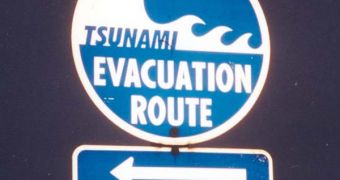
A group of investigators spearheaded by experts at NASA managed recently to demonstrate the basic elements of a new type of tsunami prediction system. Their approach relies on a number of scientific instruments, which are capable of conducting earthquake analysis with high speed, and then calculate the risk of a possible tsunami taking place. The system is also in charge of determining the size and trajectory of the waves, so that it can be enabled to send warnings to the targeted areas. Speedy analysis is key in such circumstances, especially if a tremor takes place near the shore.
When tremors occur underwater, tectonic plate movements release so much energy into the water that disturbances occur. Over extensive distances, these variations are amplified by several orders of magnitude, giving birth to monster waves. As these near the shores, they gain increasing momentum, and become tsunamis. When they make contact with land, they travel at great speeds, and are also very high. The momentum they carry enables them to smash virtually everything in their path, as evidenced by the 2004 devastation that struck Sri Lanka, Indonesia, India and other countries.
In a bid to ensure that disasters such as this do not occur again, researchers at the NASA Jet Propulsion Laboratory (JPL) in Pasadena, California, led by expert Y. Tony Song, decided to try a new approach to predicting the large waves. They collected data from the space agency's Global Differential GPS (GDGPS) network, which puts together global and regional real-time data from a huge number of GPS sites around the world. The tool is very sensitive, capable of identifying even a couple of centimeters of crust movement in a matter of seconds.
“This successful test demonstrates that coastal GPS systems can effectively be used to predict the size of tsunamis. This could allow responsible agencies to issue better warnings that can save lives and reduce false alarms that can unnecessarily disturb the lives of coastal residents,” Song believes. “The value of coordinated real-time observations from precision GPS, satellite altimetry and advanced Earth models has been demonstrated,” concludes the manager of the Solid Earth and Natural Hazards program, John LaBrecque. He is based in Washington DC, at the NASA Science Mission Directorate (SMD) Earth Science Division.

 14 DAY TRIAL //