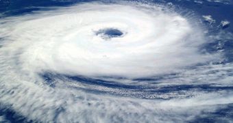
Cyclones, the enormous atmospheric movements centered around a very low pressure center, and which are able to generate severe thunderstorms and flooding rain, kill the most people in areas of the Indian Ocean. Statistics show that 15 percent of the cyclones occur in the region, but that they are nonetheless responsible for nearly 80 percent of the deaths attributed to these atmospheric events worldwide. Now, the NASA American space agency combines a new mathematical model with a better type of data integration, in hopes of being able to predict such occurrences before they happen.
Most of the victims in the vicinity of the Indian Ocean, who used to live in the region stretching from the tip of India to Thailand, were unable to evacuate their homes in time, because meteorologists couldn't accurately predict where the storms would hit. As an example, the 2008 Cyclone Nargis struck Burma (Myanmar), after it unexpectedly veered off-course.
It killed 135,000 people, destroyed $1.2 billion-worth of property, and forced tens of thousands to be evacuated. Taking this case study as an example, NASA and the National Ocean and Atmospheric Administration (NOAA) have worked together on analyzing how Nargis formed and why it shifted course so rapidly.
In a study published in the March 26th issue of the journal Geophysical Research Letters, experts announced that they managed to “hindcast” Nargis' path, which means that they were able to plot the course of the storm, since it began to form until its surges started killing people.
“There is no event in nature that causes a greater loss of life than Northern Indian Ocean cyclones, so we have a strong motivation to improve advance warnings,” Oreste Reale, who is an atmospheric modeler at the Goddard Earth Sciences and Technology Center, which is the result of a partnership between NASA and the University of Maryland-Baltimore County, explained. Reale is also the lead author of the new paper.
After Nargis, Reale and his team of researchers worked hard to create a new information-gathering network, dubbed the Data Assimilation and Forecasting System known as GEOS-5. In addition, the fruitful cooperation between the two agencies also yielded an analysis tool, which was created based on the readings recorded for the cyclone before it intensified and became lethal. Reale shared that this storm was particularly relevant to their new analysis and forecasting instruments, because it captured the “essence” of Northern Indian Ocean storms.
“With this approach, we can now better define cyclones at the early stages and track them in the models to know what populations may be most at risk. And every 12 hours we gain in these forecasts means a gain in our chances to reduce loss of life,” Reale added. Hopefully, the expert maintained, the new systems would be enough to get past the “blind spots” in the region, areas in which atmospheric data on the storm are very few or non-existent. In other regions of the globe prone to the influence of cyclones, the new system could offer even more detailed, advanced warnings, potentially saving thousands of lives.

 14 DAY TRIAL //