A volcano is a spectacular sight no matter where you watch it from. Granted, trying to get a good look at an active volcano, one that is erupting no less, does come with some disadvantages, including death.
It's safer to do it from a distance, but if you're doing it from space, it's probably even more spectacular.
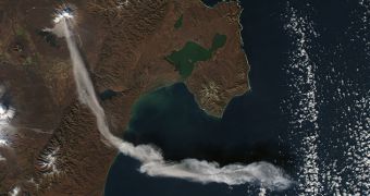
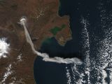
Case in point are some recent images from NASA's Earth Observatory of the Shiveluch Volcano, one of the largest and most active in the Kamchatka peninsula.
NASA's Terra satellite passed over the volcano on October 6th and everything seemed fine. The volcano has been erupting since 1999, but was calm at that moment.
Two hours later though, NASA's Aqua satellite got a completely different picture, quite literally. The volcano had erupted and had sent a huge amount of smoke and material into the atmosphere.
The plume had already traveled 90 km or 55 miles in that time. The photos tell the entire story. If you're a Google Earth user, NASA also created a KMZ file with the before and after imagery to enjoy in 3D.

 14 DAY TRIAL //
