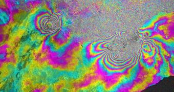
Following the recent eruption of a volcano in Hawaii, NASA has decided to begin a new investigations campaign, whose main goal will be to get more insight into what's going on beneath the Earth's surface at this location.
The processes underlying volcanic eruptions, earthquakes and the formation of tsunamis are all interlinked, but experts have yet to get a full grasp on them. Experts with the American space agency hope that this will allow them to determine their nature more exactly.
A heavily-modified aircraft will be sent to survey the Kilauea volcano, which is located on the Big Island of Hawaii. The Unmanned Aerial Vehicle Synthetic Aperture Radar (UAVSAR) will be used for this investigation.
The instrument is installed aboard a heavily-modified Gulfstream II aircraft that NASA operates out of the Dryden Aircraft Operations Facility, in Palmdale, California. The radar itself was designed and built at the Jet Propulsion Laboratory (JPL), in Pasadena.
According to the NASA flight manifest, the first flight sortie is scheduled for Sunday, April 3. The mission will initially last for about nine days, but there is a possibility that the flight scheduled will be extended for as long as it takes.
UAVSAR conducts its studies via a technique called interferometric synthetic aperture radar. This works by sending light pulses in the microwave portion of the electromagnetic spectrum to the ground.
These pulses are capable of revealing the existence of any slight deformations that may exist on the crust. Phenomena such as earthquakes, volcanoes, landslides and glacier movements are oftentimes responsible for causing such deformations.
Readings of Hawaii will be conducted from an altitude of about 12,500 meters (41,000 feet). The data obtained in this manner will then be cross-referenced with a similar database, that was put together during the first UAVSAR flight over Hawaii, in January 2010.
“The April 2011 UAVSAR flights will capture the March 2011 fissure eruption surface displacements at high resolution and from multiple viewing directions, giving us an improved resolution of the magma injected into the east rift zone that caused the eruption,” says Paul Lundgren.
He holds an appointment as a research scientist at the JPL. “Our goal is to be able to deploy the UAVSAR on short notice to better understand and aid in responding to hazards from Kilauea and other volcanoes in the Pacific region covered by this study,” the expert adds.

 14 DAY TRIAL //